Research Guides | Early Maryland History
Early Maryland History
Colonial Period (1633-1763)
- Narratives of Early Maryland, 1633-1684 - Edited by Clayton Coleman Hall, this collection of writings contains instructions to the colonists from Cecilius Calvert, 2nd Baron of Baltimore; Father Andrew White's account of the voyage to Maryland on the Ark and the Dove; reports of conferences between Charles Calvert, 3rd Baron of Baltimore and William Penn; and many other items detailing the early years of Maryland’s founding.
- Digital Maryland's Hugh H. Young Collection of Colonial Maryland Papers, from the Special Collections Department at the Enoch Pratt Free Library/State Library Resource Center (SLRC), contains letters from Charles Calvert to William Penn, early accounts of Native Americans in the Chesapeake, and a rough sketch of the Chesapeake's headwaters, among other notable items.
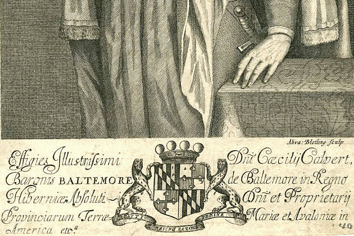
- The Calvert papers - Read about the discovery of the papers of Maryland’s founding family. Included is a calendar, and selections from the papers. You can also read a contemporary account of their acquisition in “Unearthing the Calverts.”
- Early Settlers of Maryland - This research database lists individual settlers who are named in the Maryland land patent volumes from 1633 to 1685.
- Archives of Maryland Online provides access to over 471,000 historical documents that form the basis of Maryland's government.
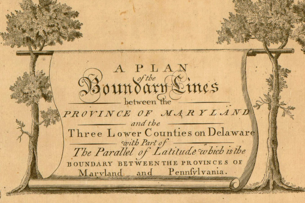
- The Maryland - Pennsylvania Boundary Line Dispute - The Library of Congress has digitized the map created from the surveys of Charles Mason and Jeremiah Dixon. The story of the survey is on the blog underbelly.
- The Maryland Provincial Papers are housed at the Maryland State Archives. This collection of colonial period papers is arranged chronologically and pertains to the northern and eastern boundaries of the province. Included are letters, petitions, depositions, articles of agreement, proceedings of the commission to survey boundaries and commission to execute agreement, leases, surveyors' field notes and journals, Mason and Dixon astronomical observations and journals, and surveys and maps of boundary areas.
- The Mason Dixon Resurvey Commission Report from 1909 and the Messages from the Governors of Maryland and Pennsylvania, ...in relation to the intersection of the boundary lines of the state of Maryland, Pennsylvania, and Delaware, 1850 are both made digitally available by Hathitrust.
Revolutionary Era (1764-1789) - War of 1812 (1812-1815)
- Benjamin Banneker - The Library of Congress created a collection of online resources about Banneker. Additionally, the Maryland Historical Society has his original “Astronomical Journal (MS2700)” and early almanacks. You can read a brief blog piece about the collection. Lastly, A Sketch of the Life of Benjamin Banneker from notes taken in 1836 by Martha Ellicott Tyson, and the biography, The Life of Benjamin Banneker by Silvio Bedini are also highly recommended.
- Charles Carroll of Carrollton - The Charles Carroll House of Annapolis provides biographical information about Charles Carroll. The Maryland Historical Society's collection of Carroll-McTavish Papers (MS220) are available to their visitors. This is one of their many collections pertaining to Charles Carroll. The first three volumes of Charles Carroll Papers Dear Papa, Dear Charley..., edited by Ronald Hoffman, Sally D. Mason, and Eleanor S. Darcy, were published by UNC Press in 2001, and can be found in many libraries throughout the state.
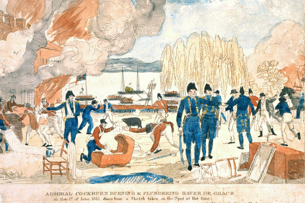
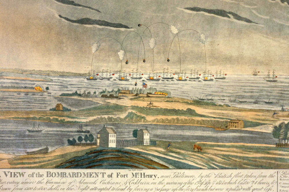
- The War of 1812 in Maryland - Digital Maryland hosts a large collection of digital items relating to the War of 1812 from the Maryland Historical Society's collection.
- Francis Scott Key Papers and related manuscripts can be found at the Maryland Historical Society by searching their library catalog, and the original Star Spangled Banner manuscript can be seen there on display.
- Visualizing Early Baltimore - An interactive map and virtual 3D model, created by the Imaging Research Center at the University of Maryland Baltimore County, recreates Baltimore at the turn of the 19th century.
Searching Early Maryland by Physical Format
- Manuscripts - For information on manuscript collections in Maryland, search Archive Grid. Use the “search by location or zip” function to view repositories in the state of Maryland.
- Researching Early Maryland at the Maryland Historical Society - The staff at the Maryland Historical Society created detailed subject guides for topics including the Revolution in Maryland, Maryland Women, the War of 1812, and African American History. These guides contain primary sources unique to the Maryland Historical Society’s collection, as well as secondary sources found at other institutions. Before visiting their library, review their rules and procedures for accessing their material, and their guide for searching the manuscript collections online.
- Historic Newspapers - Learn more about the Pratt Library's collection of Historic Maryland Newspapers.
- The Maryland State Archives has a selection of digitized newspapers available online.
- The Chronicling America project at the Library of Congress includes digitized newspapers from 1836-1922. There is also a directory of U.S. Newspapers, 1690 to present.
Maps & Land Records
- The Library of Congress has a large selection of digitized maps from the state of Maryland. Some examples include maps from 1738, 1795 (1), 1795 (2), and 1799.
- The Maryland Historical Society has a large collection of maps in their special collections reading room.
- Digital Maryland has made maps of Maryland from the Enoch Pratt Free Library/SLRC's collection available online.
- Early land records in the collection of the Maryland State Archives are available online through plats.net.
Visual Material (Prints and Photos)
- Photos: Digital Maryland, the Library of Congress, and the Maryland Historical Society are good sources for early photographs available online. Local libraries and historical societies can be great sources for original photographs, though a trip to the institution is usually required as most material is not available digitally.
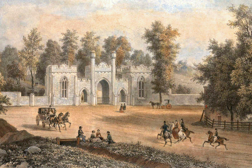
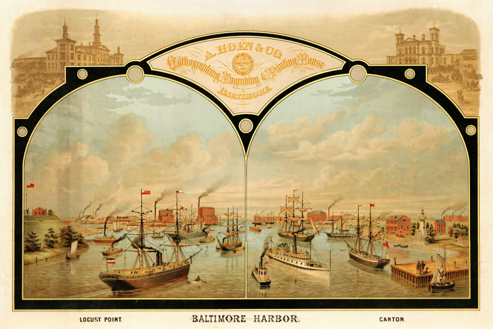
- Prints: A large selection of prints is available through the Maryland Historical Society. If you're interested in seeing more Maryland prints, check out Maryland History in Prints, 1743-1900, by Laura Rice, and Maryland Historical Prints, 1752 to 1889: A Selection From the Robert G. Merrick Collection, Maryland Historical Society, and Other Maryland Collections, by Lois B. McCauley.
Recent Guides
 COVID-19 Vaccine Information Dec 21, 2020
- COVID-19:
Links You Can Trust Jul 23, 2020