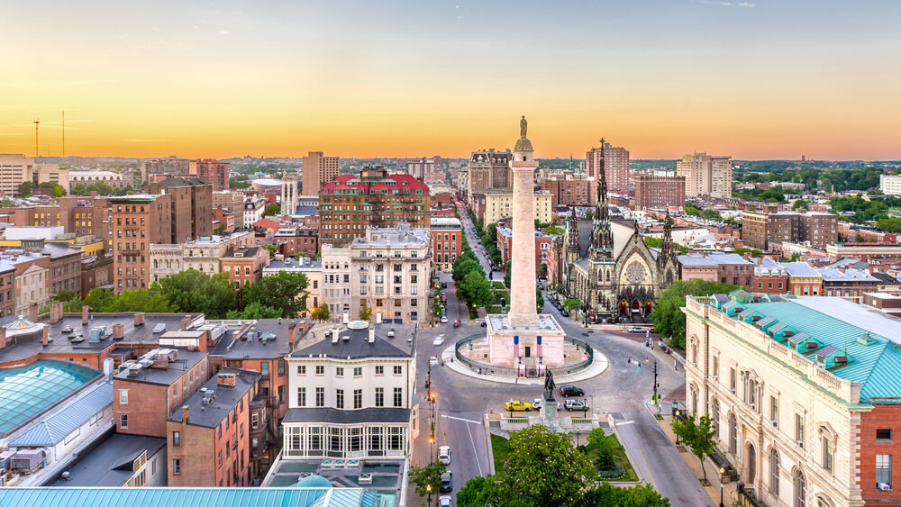
Baltimore Neighborhood Research Guide
Defining a Neighborhood
We usually think the boundaries of our neighborhood enclose the few square blocks surrounding our home, church, school, business, park or playground. However, the agencies collect, study, and disseminate Baltimore City data define neighborhoods quite differently. Geographic and social criteria provide useful information for understanding neighborhood dynamics of small areas of the city.
Using Demographics
One commonly-used method for understanding a neighborhood is to review the characteristics of the people who live there, such as age, race, gender, and other social and economic factors, and then create a demographic profile of the area. Data from the 2010 Census are now available from the Baltimore City Planning Department.
The United States Census Bureau uses semi-permanent boundaries to maintain accurate statistics. These census tracts may not fit neatly into your neighborhood's boundaries. The Baltimore City Planning Department has an interactive map of neighborhood statistical areas with census tracts. Use the Maryland State Data Center website to find information on the one or more census tracts that may comprise your neighborhood.
Community Statistical Areas (CSAs): Most neighborhoods in Baltimore City have different borders than those established in census tracts. Clusters of neighborhoods were combined along census tract boundaries, forming 55 CSAs. The Baltimore Neighborhood Indicators Alliance's Vital Signs report provides detailed demographic profiles of each CSA in Baltimore City.
Regional Planning Districts (RPDs): First developed in the 1970s, RPDs follow census geography boundaries and contain one or more census tracts. They are larger than most neighborhoods, but provide more to analyze.
Zip Codes: The U.S. Census also makes demographic data available by zip code.
Using Numerical Statistics
Crime Statistics: SpotCrime provides a crime map of Baltimore City and daily statistics by street.
Health Statistics: Neighborhood Health Profiles are published periodically by the Baltimore City Health Department in cooperation with the Johns Hopkins Bloomberg School of Public Health. Other Health Department reports include Healthy Baltimore 2015, the city's health policy agenda; the Health Disparities Report Card 2013; and the Baltimore Community Health Survey 2014.
Economic Statistics: Live Baltimore provides home sales statistics about Baltimore City neighborhoods and information about new neighborhood developments. Vital Signs is BNIA's report for home sales data, neighborhood affordability information, and statistics concerning vacant/abandoned properties and reinvestment activity.
Plans for the Future: Neighborhood Plans details Master Plans and Urban Renewal Plans for the futures of many Baltimore neighborhoods, prepared by the Baltimore City Planning Department.
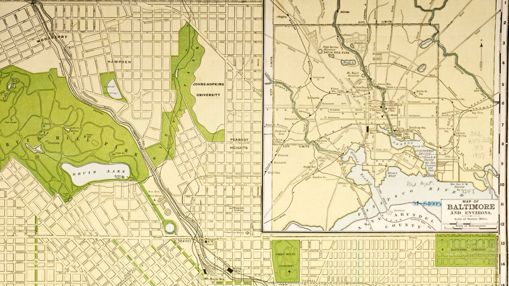
Using Maps: the Baltimore City Planning Department Maps include neighborhood maps overlaid with zip codes, census tracts, and city council districts. The Baltimore Regional Green Map is an interactive map that identifies natural, cultural, and social resources. Historic District Maps are historic maps of each district in Baltimore City, paired with a brief article about its history and significance.
Discovering the History of a Neighborhood
The Pratt Library's Maryland Department is a great place to visit for neighborhood history research using the following resources.
- Neighborhood History Books: to find published Baltimore neighborhood histories, search for the name of your neighborhood in the Pratt Library catalog.
- Vertical Files: file folders containing news clippings, pamphlets, brochures, etc. full of interesting information about city neighborhoods.
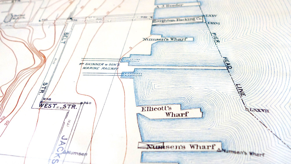
- Historic Maps
- Maryland & DC Sanborn Maps show the locations and construction information of all buildings and houses on each street in Baltimore City between 1890 and 1984.
- Sachse Map of Baltimore City is a detailed map that provides a unique portrait of Baltimore City, its businesses, houses, institutions, and landscapes, as they appeared in 1869.
- Aerial Photographic Map of Baltimore and Metropolitan District of Baltimore County, photographed by the Chesapeake Aircraft Company between October, 1926, and February, 1927. Also available in hard copy in the Maryland Department.
- Baltimore City Census District Maps: show changes in census districts over time. Available in hard copy in the Maryland Department.
- Photographs : many of the mounted black & white photographs (mainly dating from the 1930s to the 1950s) in the Maryland Department collection show Baltimore streets, street corners, and notable buildings. They are often used for neighborhood history research.
Neighborhood-Related Resources
- Baltimore City Council District: find your council district, council representative and polling place.
- Baltimore City's Online Community Association Directory : find a local group that advocates for your neighborhood.
- Baltimore Main Streets provides customized support and public resources to designated neighborhood business districts.
- Fair Housing Action Center of Maryland works for justice in housing through compliance with fair housing and tenant-landlord laws.
- Office of Home Energy Programs provides subsidies to help low-income residents with their heating and cooling bills.
- Baltimore City Neighborhood Fire Stations provides details about the 38 fire stations in Baltimore and the communities they serve.
Getting Involved in Your Neighborhood
- Parks and People Foundation: get involved with your community in park and natural resource revitalization.
- Baltimore Community Foundation's Neighborhood Grants Program offers small grants to help community organizations in Baltimore City and Baltimore County complete neighborhood improvement projects, develop new neighborhood leaders.
Recent Guides
 COVID-19 Vaccine Information Dec 21, 2020
- COVID-19:
Links You Can Trust Jul 23, 2020